

Promotion of Service-Related Measures
In addition to steadily implementing infrastructure-related measures such as the construction of river control structures, the Bureau also takes service-related measures, including providing information on rainfall and river levels and broadening the public interest in and knowledge of rivers, to protect the lives and livelihoods of residents from disasters such as heavy rains, floods, storm surges, and landslides.
Providing River-Related Information
Providing Information via the Internet and Other Means
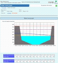
On the website of the Tokyo Metropolitan Government Integrated Flood Prevention Information System, the TMG provides information concerning flood risk, including rainfall, river levels, river images from monitoring cameras, and flood forecasts.
Information on flood risk is also provided via Twitter.
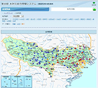
Tokyo Metropolitan Government Integrated Flood Prevention
Information System
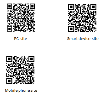
PC site http://www.kasen-suibo.metro.tokyo.jp/im/uryosuii/tsim0102g_en.html
Smart device site https://www.kasen-suibo.metro.tokyo.jp/s/tsim0401g_en.html
Mobile phone site http://www.kasen-suibo.metro.tokyo.jp/im/i/tsim0201g_en.html
The TMG’s Twitter account for flood warnings
Twitter http://twitter.com/tokyo_suibo

Issuance of Flood Forecasts and Other Information
For some rivers, including the Kanda and Shakujii rivers, the TMG issues flood warnings when there is a risk of an overflow.
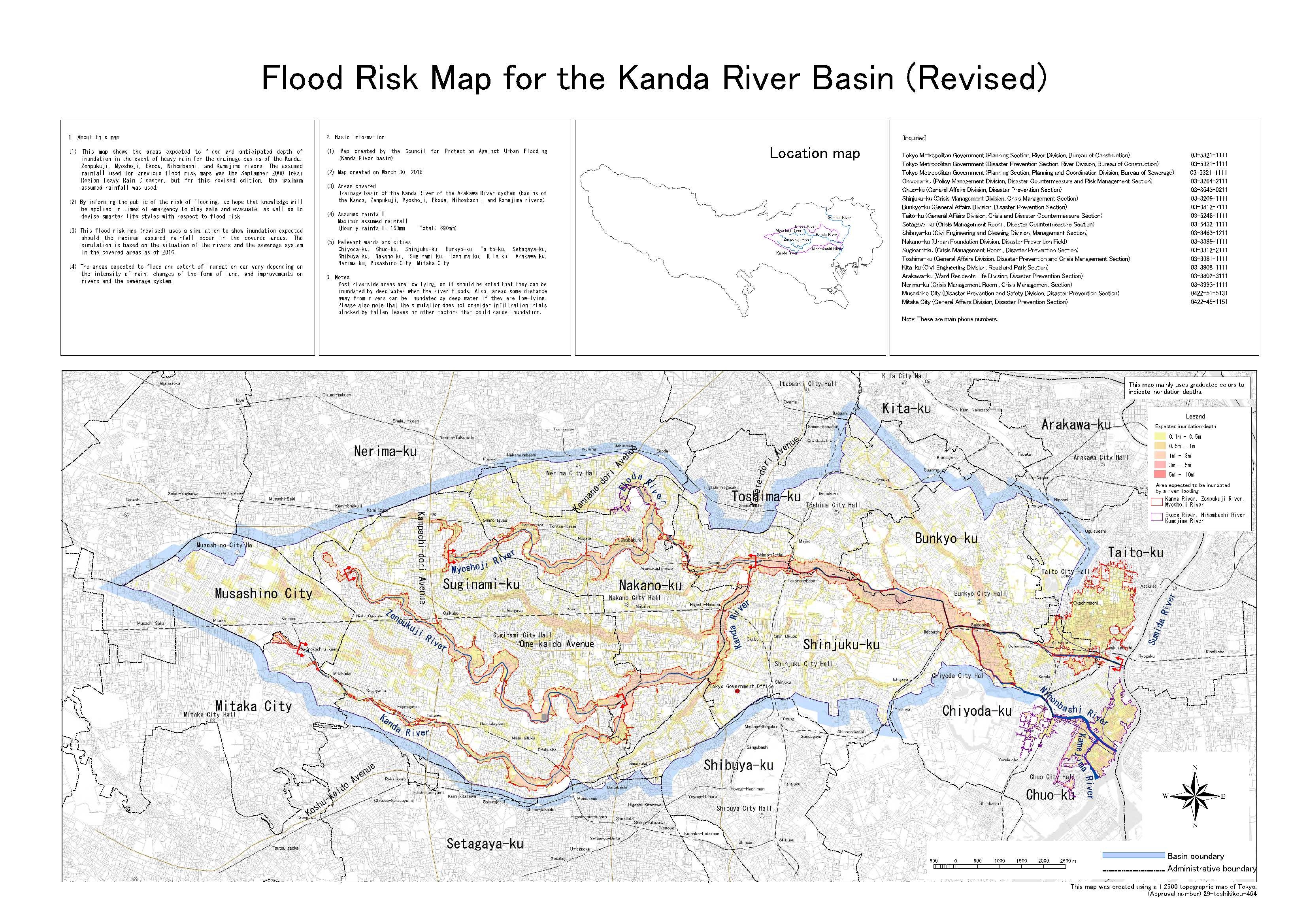
Publication of Flood Risk Maps
The Bureau creates and publicizes flood risk maps so that municipalities and residents can better prepare for potential floods.
Flood risk map shows the area that is more likely flooded and depth of water in the area in the case of a heavy rain in the basins.
●Flood Risk Map
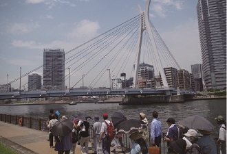
Broadening the Public Interest in and Knowledge of Rivers
In July, which is designated as River Month, a wide range of events are held every year, including riverside walking tours, study tours to river control facilities, trash pickup events, exhibitions, photo contests, and symposiums.